


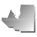
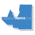
Cole, Callaway, Moniteau & Osage Counties PUMA, Missouri
About
Outline

Summary
| Unique Area Identifier | 193276 |
| Name | Cole, Callaway, Moniteau & Osage Counties PUMA |
| State | Missouri |
| Area (square miles) | 2,278.60 |
| Land Area (square miles) | 2,247.70 |
| Water Area (square miles) | 30.91 |
| % of Land Area | 98.64 |
| % of Water Area | 1.36 |
| Latitude of the Internal Point | 38.63712070 |
| Longtitude of the Internal Point | -92.08922750 |
Maps


Graphs
Select a template below for downloading or customizing gragh for Cole, Callaway, Moniteau & Osage Counties PUMA, Missouri


Neighbors
Neighoring Public Use Microdata Area (by Name) Neighboring Public Use Microdata Area on the Map
- Boone County PUMA, MO
- Lincoln, Warren, Audrain, Pike & Montgomery Counties PUMA, MO
- Pettis, Randolph, Saline, Cooper, Howard, Carroll & Chariton Counties PUMA, MO
- Phelps, Crawford, Dent, Gasconade & Maries Counties PUMA, MO
- Pulaski, Camden, Miller & Morgan Counties PUMA, MO
Top 10 Neighboring County (by Population) Neighboring County on the Map
- Boone County, MO (162,642)
- Cole County, MO (75,990)
- Callaway County, MO (44,332)
- Audrain County, MO (25,529)
- Miller County, MO (24,748)
- Morgan County, MO (20,565)
- Cooper County, MO (17,601)
- Moniteau County, MO (15,607)
- Gasconade County, MO (15,222)
- Osage County, MO (13,878)
Top 10 Neighboring County Subdivision (by Population) Neighboring County Subdivision on the Map
- Columbia township, Boone County, MO (62,961)
- Jefferson township, Cole County, MO (54,165)
- East Fulton township, Callaway County, MO (10,231)
- Salt River township, Audrain County, MO (9,497)
- Summit township, Callaway County, MO (8,873)
- Rocky Fork township, Boone County, MO (8,397)
- Saline township, Miller County, MO (8,315)
- Rock Bridge township, Boone County, MO (8,261)
- Liberty township, Cole County, MO (7,330)
- West Fulton township, Callaway County, MO (7,269)
Top 10 Neighboring Place (by Population) Neighboring Place on the Map
- Jefferson City city, MO (43,079)
- Fulton city, MO (12,790)
- California city, MO (4,278)
- Tipton city, MO (3,262)
- Holts Summit city, MO (3,247)
- Belle city, MO (1,545)
- Wardsville village, MO (1,506)
- Linn city, MO (1,459)
- St. Martins city, MO (1,140)
- Auxvasse city, MO (983)
Top 10 Neighboring Elementary School District (by Population) Neighboring Elementary School District on the Map
- Moniteau County R-V School District, MO (1,100)
- High Point R-III School District, MO (811)
- Clarksburg C-2 School District, MO (805)
Top 10 Neighboring Unified School District (by Population) Neighboring Unified School District on the Map
- Columbia Public Schools, MO (136,836)
- Jefferson City Public Schools, MO (71,991)
- Fulton School District, MO (19,130)
- Mexico 59 School District, MO (15,366)
- Eldon R-I School District, MO (12,072)
- Gasconade County R-II School District, MO (11,820)
- Boonville School District, MO (11,591)
- Morgan County R-II School District, MO (11,110)
- Montgomery County R-II School District, MO (8,610)
- Southern Boone County R-I School District, MO (7,932)
Top 10 Neighboring State Legislative District Lower Chamber (by Population) Neighboring State Legislative District Lower Chamber on the Map
- State House District 24, MO (46,896)
- State House District 99, MO (42,788)
- State House District 25, MO (40,532)
- State House District 21, MO (39,438)
- State House District 20, MO (38,233)
- State House District 115, MO (37,008)
- State House District 114, MO (36,525)
- State House District 117, MO (35,534)
- State House District 113, MO (35,216)
- State House District 10, MO (35,091)
Top 10 Neighboring State Legislative District Upper Chamber (by Population) Neighboring State Legislative District Upper Chamber on the Map
- State Senate District 16, MO (188,295)
- State Senate District 19, MO (188,056)
- State Senate District 6, MO (181,242)
- State Senate District 21, MO (163,305)
- State Senate District 18, MO (159,547)
Top 10 Neighboring 111th Congressional District (by Population) Neighboring 111th Congressional District on the Map
- Congressional District 6, MO (693,974)
- Congressional District 9, MO (684,101)
- Congressional District 4, MO (679,375)
Top 10 Neighboring Census Tract (by Population) Neighboring Census Tract on the Map
- Census Tract 18.05, Boone County, MO (9,020)
- Census Tract 108, Cole County, MO (8,853)
- Census Tract 19.02, Boone County, MO (8,249)
- Census Tract 201.98, Cole County, MO (7,324)
- Census Tract 703, Callaway County, MO (7,284)
- Census Tract 17.01, Boone County, MO (6,909)
- Census Tract 104, Cole County, MO (6,896)
- Census Tract 706, Callaway County, MO (6,426)
- Census Tract 204, Cole County, MO (6,327)
- Census Tract 707, Callaway County, MO (6,294)
Top 10 Neighboring 5-Digit ZIP Code Tabulation Area (by Population) Neighboring 5-Digit ZIP Code Tabulation Area on the Map
- 65203, MO (53,307)
- 65202, MO (46,547)
- 65201, MO (39,417)
- 65109, MO (38,090)
- 65101, MO (30,587)
- 65251, MO (22,437)
- 65265, MO (15,409)
- 65026, MO (11,551)
- 65043, MO (9,452)
- 65018, MO (7,714)